GPRS Investigates For Underground Storage Tanks – Gary, Indiana
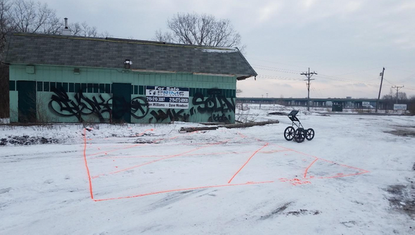
GPRS was contacted by a engineering firm to investigate for any buried structures or possible underground storage tanks (USTs). After arriving on site, the firm let GPRS know that there had been a truck stop with diesel filling stations at one point dating back all the way to the late 40’s or early 50’s.
There was no clear documentation stating whether the USTs had been removed or abandoned in place, so GPRS did what we do best; create a strategy to provide the best subsurface scanning solution.
GPRS scanned the area with Electromagnetic Induction (EMI) equipment, and we were able to provide conductivity maps that represented the data collected from the scanning process and overlaid on to Google Earth. GPRS also provided a detailed report which included maps of any utilities around the area as well as where the suspect tanks were to be. Data screenshots were saved for the reporting as well.
“Time is a primary currency traded on any given construction project. At Ground Penetrating Radar Systems, our everyday efficiency in operations allows us to respond to the immediate needs of our customers, often within 24 hours or less.”
Our state of the art GSSI GPR equipment sends radio signals into concrete that send the data back instantly for real-time interpretation. The radio waves are safe for workplaces so there is no need for any stop in work for floors below or around the scan areas. GPRS also uses the RD-8100 Locator to locate live power and radio frequency (RF) signals underground. We can also detect utilities in or under concrete using our transmitter box which sends out a frequency via induction or conduction with an exposed or known surface utility line.
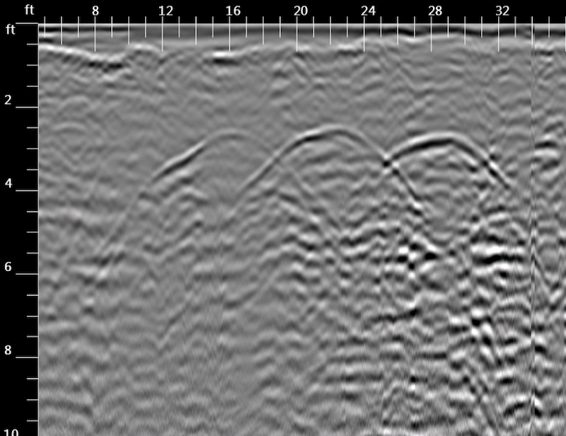
* The depth scale is on the left and the distance of the scan is across the top, forming a cross section view of the subsurface. The red brackets surround anomalies that are consistent with 3 possible USTs, buried structures, or other unknowns. The red arrows point to the approximate center of each anomaly.
“GPRS deploys the best equipment operated by skilled project managers who know how solve your subsurface locating issue. Since our inception, GPRS has completed hundreds of thousands of projects in North America. Our accuracy rate on these projects? Over 99%.”
GPRS technicians are commonly called for wide array of locating, such as concrete scanning for rebar, mesh, conduits, radiant tube heating, post tension cables, and any other utility that may be buried. We also scan for private and public utility locates, underground voids or vaults, footings, buried foundations, and Underground Storage Tanks (UST’s). All these tasks are all done in a safe, time efficient, non-destructive manner.
Scan before you plan! This ensures worker safety and saves valuable time by targeting specific areas of concern. GPRS can provide GPS reports overlaid on Google Earth or overlay information on pre-existing CAD files for future building plans.
At GPRS, safety is one our #1 priority. When saw cutting, digging, or drilling the last thing you, or our technicians, want is to run into any problems. While you may think that there is nothing buried in the concrete or ground, better think again… There is an unfortunate number of people that call because they were proven wrong. The price of one of our technicians is well worth it compared to the costs of repairing a mishap later on.
For questions or quotes on any subsurface locating in the Greater Chicagoland Area with fast response times and easy scheduling, please contact Zack Walter: zack.walter@gprsinc.com | 224-563-4445.